Share
By Elaine Nicholls, Spatial Data Analyst, GeoPlace
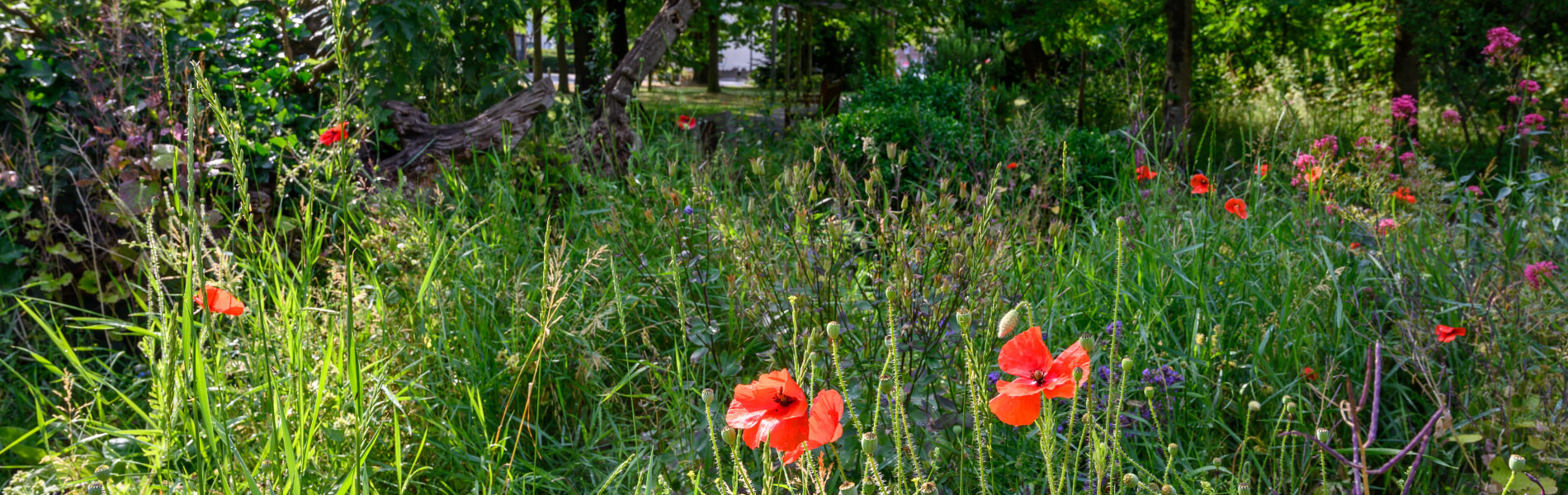
Greenspace is essential for our well being. Being in the open air contributes to our mental and physical health and, in the UK, we’re fortunate to have a great deal of green space we can get to relatively easily.
The Accessible Natural Greenspace Standard (known as ANGSt), recommends that everyone should have access to at least two hectares of green space – that’s an area about the size of two rugby pitches – no more than a five-minute walk from home. It goes on to make three other recommendations. People should have access to:
- at least one accessible 20 hectare site within two kilometres of home
- one accessible 100 hectare site within five kilometres of home
- one accessible 500 hectare site within ten kilometres of home.
Here at GeoPlace, our teams use data in many different ways to create compelling data visualisations. We wanted to show greenspace in Britain in context, to see how near (or far) away those greenspaces are from locations in five major cities. We also wanted our visualisations to be detailed and useful, and for the insights to be as accurate as possible. For that reason, we used Basic Land and Property Units (BLPUs), which give us data at an individual property level. This is much more accurate than using postcodes.
Households v postcodes
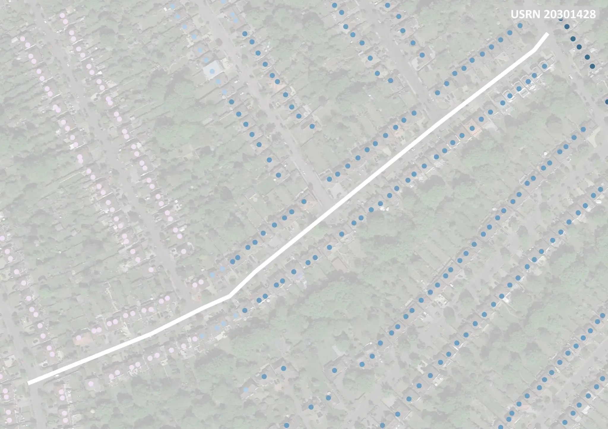
We started by using OS Open Greenspace data to identify the greenspace and see how the location of the BLPUs matched up against the ANGSt criteria. Most similar work uses postcodes as an identifier, but this can create generalisations and we wanted to avoid that problem. Multiple houses can share the same postcode, so neighbouring houses might have different access to greenspace – we get more nuanced detail from BLPUs.
This street view shows the variation that can occur at street level. Despite being on the same street, some of the houses had good accessibility to green space but others met none of the criteria. A street may have a variety of postcodes, but BLPUs give us insights at individual property level:
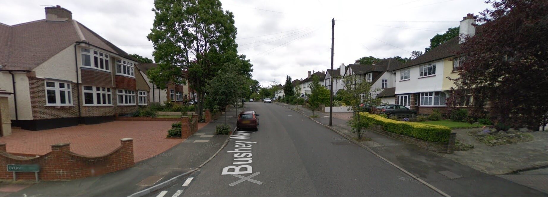
Source: Google maps, 2019
Despite the merits of OS open data as a dataset in its own right, we always wanted to enhance it further and create a bespoke, greenspace dataset. We identified areas that could be identified as greenspace that have not been captured in this data set, this includes National Nature Reserves and Local Nature reserves.
We also discounted some areas, such as cemeteries and golf courses, which – although they qualify as being green – don’t necessarily lend themselves to the inclusive, restorative ethos of greenspaces per se.
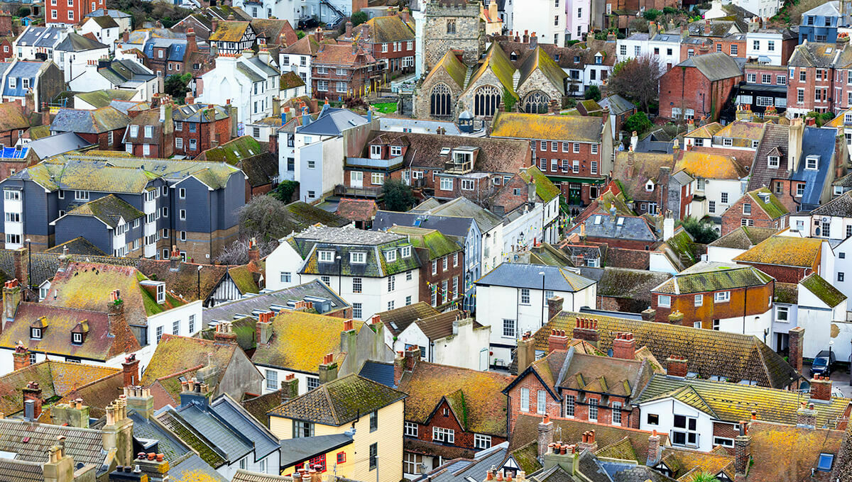
Due to the volume of BLPUs across the country-wide dataset, we decided to focus in on five major cities; three in England, one in Wales and one in Scotland. This gave us a solid representation of urban access to greenspaces. The final outcome was a set of striking data visualisations that captured each cities’ access to greenspace.
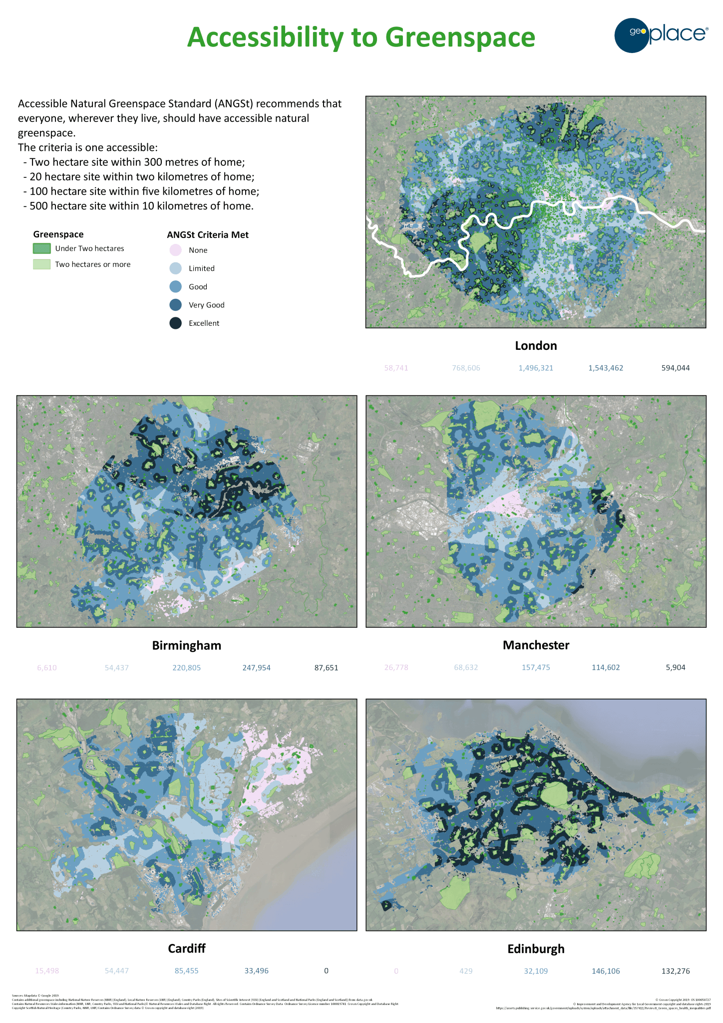
Seeing the greenspaces
Birmingham
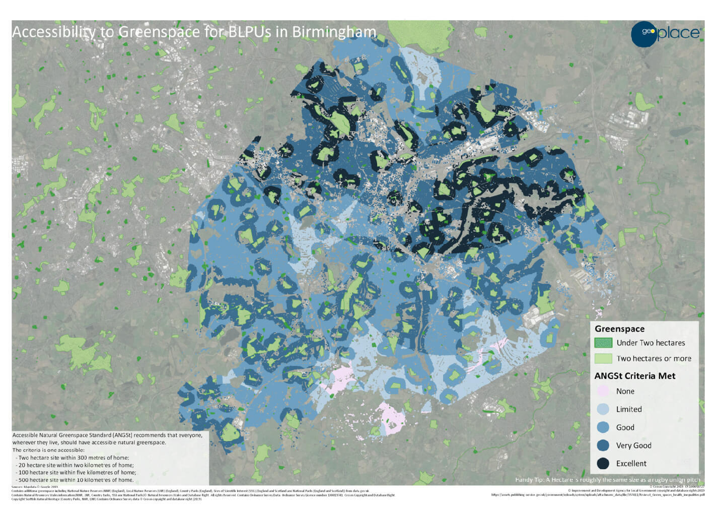
BLPU total count: 617,457
| Distance | BLPUs that can access greenspace | BLPUs that don’t meet the criteria |
| 2ha+ within 300m | 267,314 | 350,143 |
| 20ha+ within 2km | 492,852 | 124,605 |
| 100ha+ within 5km | 543,786 | 73,671 |
| 500ha+ within 10km | 286,561 | 330,896 |
Manchester
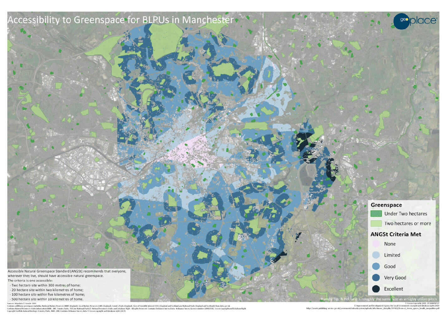
BLPU total count: 373,391
| Distance | BLPUs that can access greenspace | BLPUs that don’t meet the criteria |
| 2ha+ within 300m | 155,738 | 217,653 |
| 20ha+ within 2km | 307,376 | 66,015 |
| 100ha+ within 5km | 272,710 | 100,681 |
| 500ha+ within 10km | 14,312/11,734 10km from Peak District NP 15,180 without duplicates | 358,211 |
Cardiff
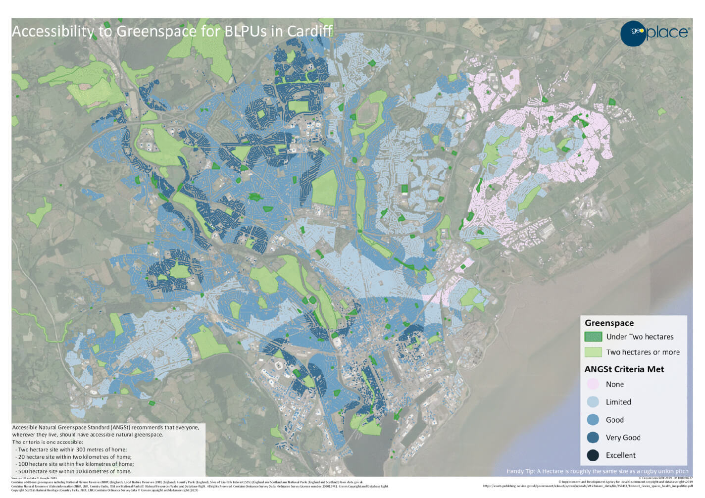
BLPU total count: 188,896
| Distance | BLPUs that can access greenspace | BLPUs that don’t meet the criteria |
| 2ha+ within 300m | 76,267 | 112,629 |
| 20ha+ within 2km | 160,755 | 28,141 |
| 100ha+ within 5km | 88,814 | 100,082 |
| 500ha+ within 10km | 0 | 188,896 |
Edinburgh
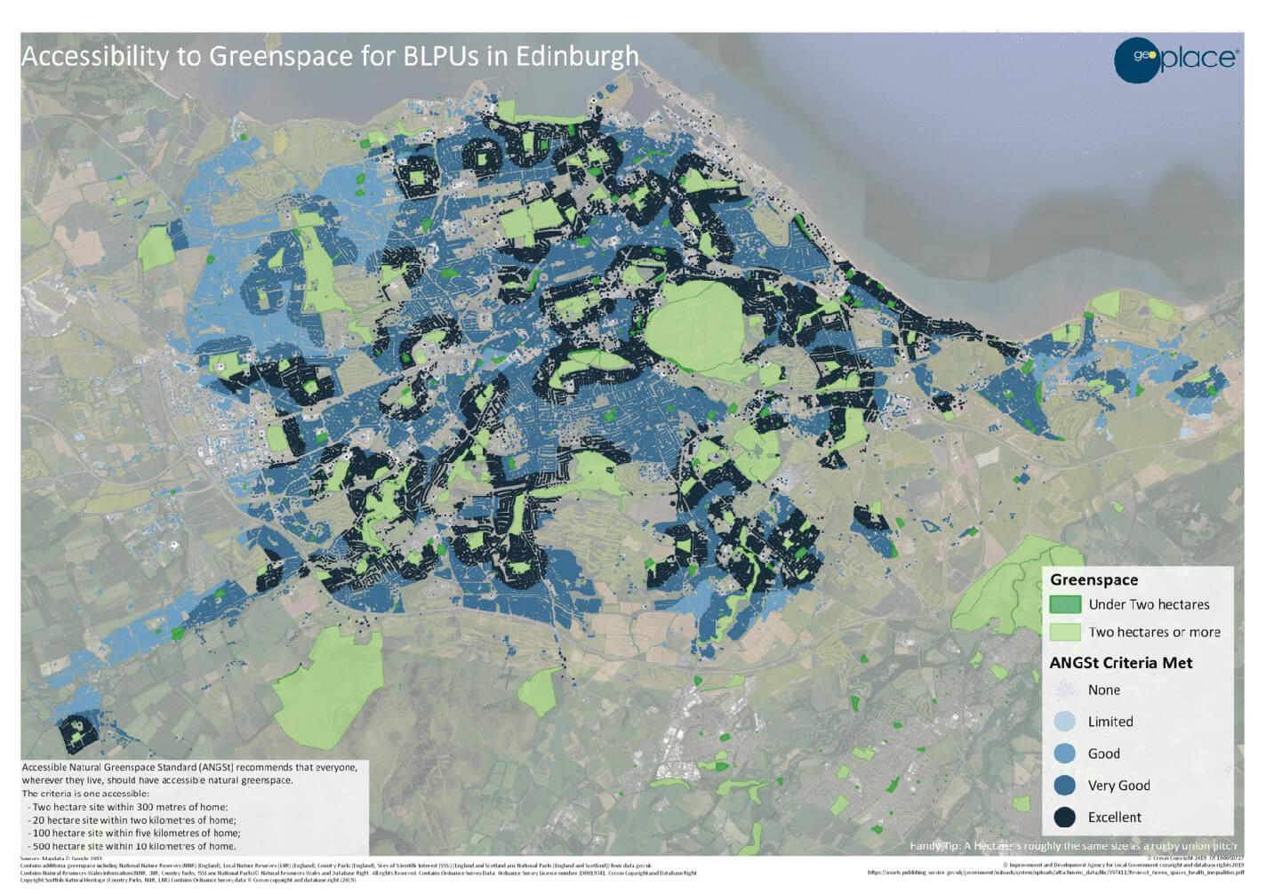
BLPU total count: 310,923
| Distance | BLPUs that can access greenspace | BLPUs that don’t meet the criteria |
| 2ha+ within 300m | 150,737 | 160,186 |
| 20ha+ within 2km | 294,371 | 16,552 |
| 100ha+ within 5km | 285,409 | 25,514 |
| 500ha+ within 10km | 301,564 | 9,359 |
London
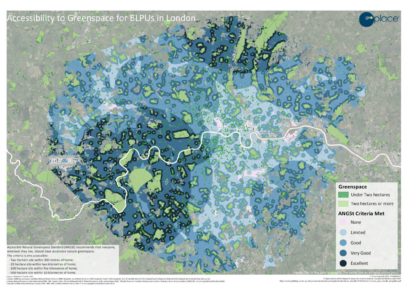
BLPU total count: 4,461,174
| Distance | BLPUs that can access greenspace | BLPUs that don’t meet the criteria |
| 2ha+ within 300m | 1,870,104 | 2,591,070 |
| 20ha+ within 2km | 4,085,038 | 376,136 |
| 100ha+ within 5km | 3,175,404 | 1,285,770 |
| 500ha+ within 10km | 1,637,264 | 2,823,910 |
Studies by the Fields in Trust charity have shown that going to parks and visiting urban greenspaces can deliver health and wellbeing benefits to people of all ages. What’s more, the government’s ‘Improving Access To Greenspace: 2020’ review shows that about £2.1bn per year could be saved in health costs, if everyone in England could access and make good use of that greenspace – so it’s important to make information about those areas widely available, and easy to analyse. This is where BLPUs play such an important role.
Making the transition from a national policy to a local, focused greenspace strategy means understanding an area in detail: putting greenspace into context for the people who need to use it. BLPUs enable analysis that helps to deliver those more-detailed insights about the role of green space in the community, how to access it, and who will benefit most from using the outdoor spaces all around us.